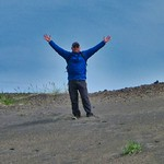
Alaska is a beautiful state, full of mountains, glaciers, and wildlife. In the summer of 2018 and again in 2019, we spent two-weeks exploring the National Park units there. Alaska is an expensive place to visit and finding information on how exactly to visit these park units can be difficult. As such, I have put together this resource guide not only documenting our trips, but providing the information and links I gathered in hopes of helping future Alaskan adventurers. Due to the parameters of posting Articles in this Questing Community, this resource guide is broken up into a four-part series. I hope you enjoy and benefit from the information and the stories I have outlined. Keep in mind, there may be many other ways to visit some of these places. This guide only outlines the adventures we had and the outfitters we used or gathered research on.
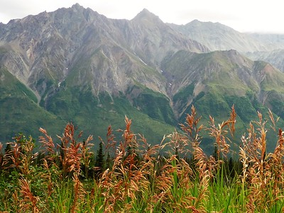
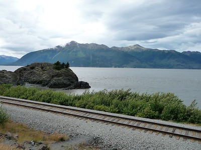
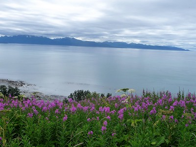
Even though Alaska had been my 50th state when I visited with my dad back in 2010, our July 2018 trip was Scott’s first time visiting. We flew into Anchorage and based out of Anchorage for a few days. The drive down to Seward from Anchorage with the water of the Turnagain Arm on one side and beautiful, snow-peaked mountains on the other is, in my opinion, the perfect introduction to Alaska’s beauty and should be one of the first experiences one has in Alaska. There are many little stop-offs/pull-outs on this drive, which takes about 2 hours, depending on traffic. It is a 2-lane highway most of the way, and traffic can get backed up behind slow drivers. (See below for some suggested stops and destinations south of Anchorage on the way to Seward).
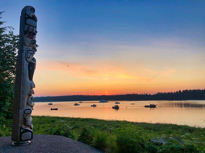
Seward is a small town on Resurrection Bay. Several cruise ships stop here, and one can hop on the Alaska Railroad up to Anchorage and other destinations.
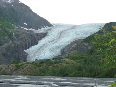
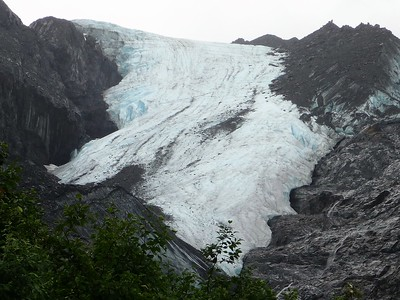
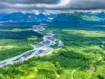
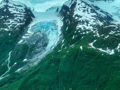
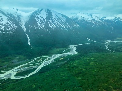
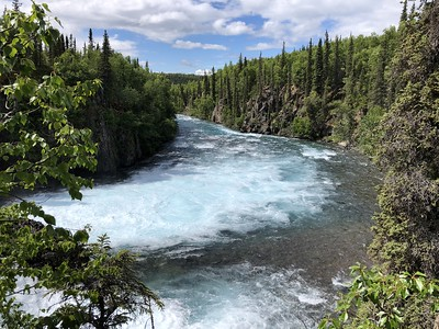
On the way into Seward, you can first visit the Kenai Fjords National Park – Exit Glacier. From the main road to Seward, the turn-off is well sign-posted. From the visitor center, we walked down an approximately one-mile trail to the panoramic vista of Exit Glacier, spilling down from the Harding Icefield. As you walk along the trail, when you reach the trail-side kiosk, there is an optional .6 mile trail to the left that continues to another overlook of the Glacier. Both are good hikes to do because they provide a different view of the glacier. They also have signs posted at various locations, showing where the glacier was at various years – demonstrating how much the glacier has receded.
Another interesting part of Seward is that this is the beginning of the Iditarod National Historic Trail, and you can visit “Mile 0”. At Mile 0, there is a small little park with a few statutes. It was fun seeing the actual start of a trail used in a race I’ve heard about my entire life.
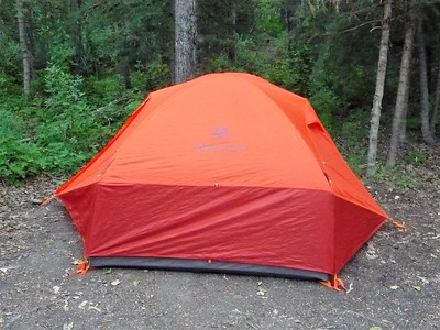
We were originally going to camp in Seward. (It ended up being very rainy and we opted to go back to our friend’s Airbnb in Anchorage). When I was planning this trip, it was difficult to find good information on the camping situation in Seward and I was a bit skeptical. But when we got there, it definitely seemed like a legit place to camp and save some money. In town, they have both RV camping and tent camping. The RV camping looked to be RV spots in a “parking lot” style. A little ways off, there were grassy tent-sites. It was only $10 per night to tent camp, with $2 showers available as well. Tents are allowed in any Seward Parks & Recreation Department (SPRD) campground, and there is tent camping also available in SPRD’s Forest Acres campground, outside the main “Downtown-Harbor Seward” area, near the Seward Resort. While you don’t necessarily need reservations, the “Tent Only” area is often close to “Full” on weekends, but everything I found indicated that one can generally always find space at Spring Creek campground outside town.
The main reason we went to Seward was for the full-day boat tour in Kenai Fjords National Park. We booked the 7.5 hour tour with Major Marine Tours, the National Park Service concessionaire for this Park. The Major Marine office was easy to find and they had directions on public parking on their website. Basically there is a pay parking lot near their office, and you can park there for 72 hours. I believe it was about $5 to park all day, which we paid at a kiosk at one end of the parking lot – you enter your slot number and then you insert your payment. We checked in at Major Marine and then did a little shopping in the few stores next to their building.
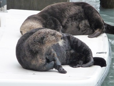
At the appropriate boarding time, we took our passes, and boarded the ship. While we were waiting to board, we saw a bunch of sea otters playing around the marina – even hopping up onto various boats. We enjoyed watching them play.
Once onboard, everyone first headed to the top of the boat. However, we snagged a table in the lower-level of the ship, which was nice. This gave us room to spread out and a place to be warm and dry (it was still cool and rainy that day). However, there are plenty of spaces off the back of the boat and on the top of the boat to go outside, see the wildlife, etc. The people that had immediately headed to the top of the boat to get a “good seat” for wildlife viewing found out later, when they were freezing, that there were no good seats left in the warm area where we had gotten our table. There was a snack bar you could buy drinks and snacks from, and you were permitted to generally roam about the boat as you pleased. They served a great prime rib and salmon lunch about half-way through the trip and were great about accommodating those with dietary restrictions. So I would highly recommend paying extra for the lunch.
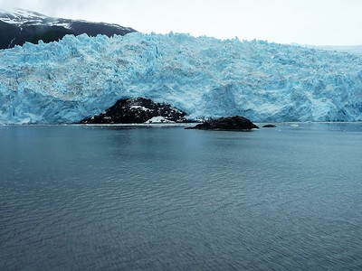
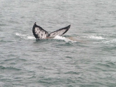
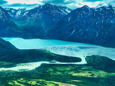
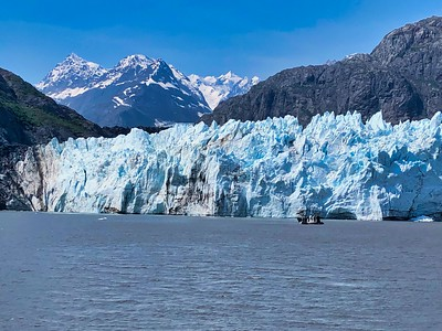
This cruise does go out into the open water of the ocean. Because there was dreary, overcast, rainy weather, the water was choppy that day and we were glad we got some extra Bonine (non-drowsy Dramamine) before we boarded. When I did this cruise in 2010, the sun was shining and the water was very smooth. The temperature was pretty cold, so we were glad we had our hats, gloves, and coats with us. Overall, the tour was amazing, as we saw harbor seals, fur seals, sea lions, puffins, and humpback whales. We saw two amazing glaciers, and were sitting there long enough to see and hear them calve. Even though it was cloudy, rainy, and cold, it was still an amazing tour of the National Park. (Pro tip – I also did this tour in 2010 with my dad, as well as the boat tour of Prince William Sound from Whittier. If you want to see more wildlife, this tour is much better. If you are more interested in seeing calving glaciers, do the Prince William Sound Tour out of Whittier. More on that later.)
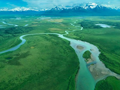
Our next adventure was to visit the six National Park Units in Northwest Alaska, near the Chukchi Sea and the southern part of the Arctic Ocean. To get there, we flew on Alaska Airlines to the tiny town of Kotzebue. Kotzebue is in the northwest part of Alaska, just above the Arctic Circle and is the gateway to the six National Park units in this area. For scale, the length of the entire town of Kotzebue is pretty close to the length of the airport runway. We were not entirely sure what to expect when we touched down and entered the one-building Kotzebue airport. As we waited for our luggage to arrive at “baggage claim,” we were amused at the type of luggage coming off the belt. With no road access and everything in the town having to come by air or sea, many townspeople returning from larger cities had used their “free luggage” allowance to bring back everyday items – boxes of food stuff, diapers, and plastic totes filled with supplies. It seemed like we were the only ones with “traditional luggage.”
Once we got our luggage, we had to figure out how to get to our Airbnb. There did not seem to be any taxis around, although the airline representative assured me there were some in the town. Our cell phones did not work well, but we were able to get a message to our Airbnb owner, who agreed to come pick us up. We decided to walk from the airport building to the road to wait for his arrival — yes, walk. He picked us up and then drove maybe 50 yards to our Airbnb, a unit above a chiropractor’s office. Had we known, we would have just walked the entire way. We did end up just walking back to the airport when we flew back to Anchorage.
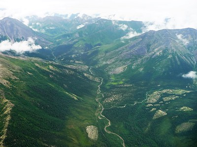
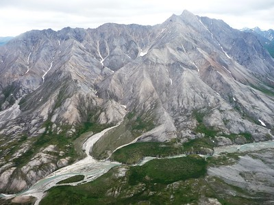
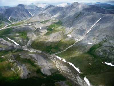
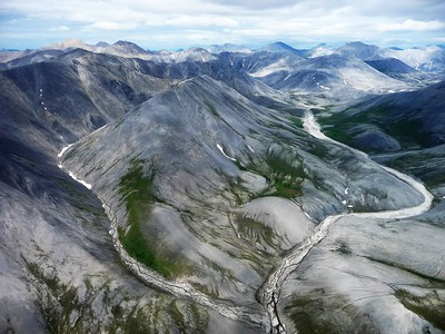
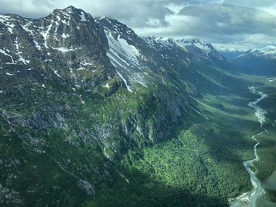
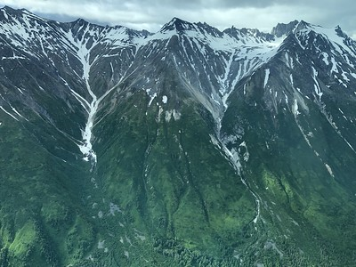
The weather was beautiful that morning, the sun was shining and there were no clouds in the sky. The one thing about Alaska weather, is it is finicky and can turn on a dime. We had six National Park Units to visit and we wanted to make sure we took advantage of this great weather while it lasted. There are no roads to these six parks and the only way to get to them is by bush plane. During my research, I found that you could go to the eastern of these six parks from Bettles, Alaska, but from Bettles, you could not reach all six of the parks. One advantage of trying to do the eastern three parks from Bettles, is that you take a float plane, which would ensure that you could land in Gates of the Arctic National Preserve – where you must land on a lake or a river.
While we ultimately did not choose the Bettles option, here is the information I gathered. From Fairbanks, you can take a flight with Wright Air Service to Bettles (70 minute flight, $340 round trip, 1-2 flights per day, limited luggage allowed). I believe the following are possible companies you can contact to land in Gates of the Arctic National Park and also the Preserve: Coyote Air Service, Brooks Range Aviation.
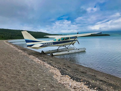
However, flying out of Kotzebue, you could possibly reach all six units, depending on weather and water levels. There is only one airline company in Kotzebue that is willing to do these flights: Golden Eagle Outfitters. Jared Cummings, the owner, and Stacy, his assistant, were excellent to work with. We had many email conversations leading up to our arrival to ensure he knew that we wanted to actually touch down within each park boundary. So when we landed in Kotzebue and tossed our things in our AirBnb, we walked over to his office, which is right by the airport. All six parks would be about 8 hours of flying (in 2018, it was a total of $5200 for the plane for the 8 hours), and we were game to get started right away to take advantage of the beautiful weather.
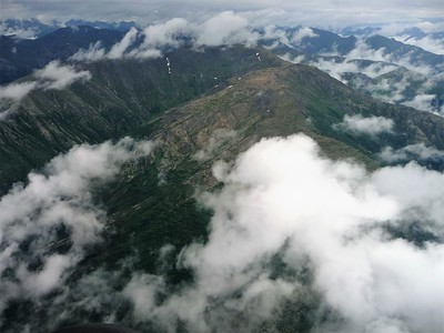
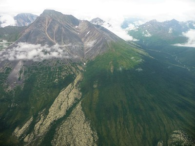
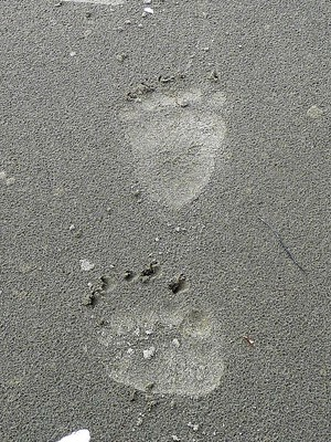
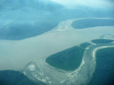
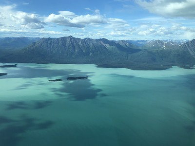
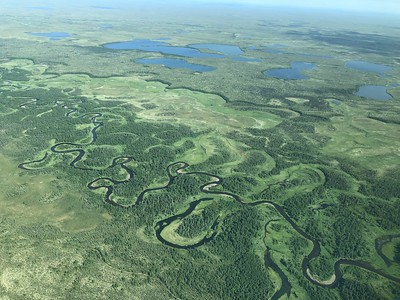
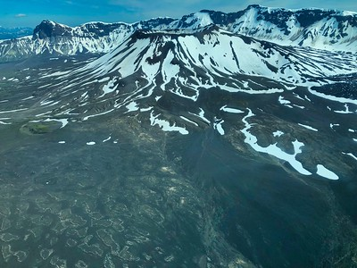
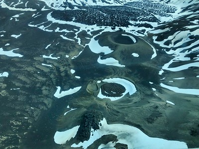
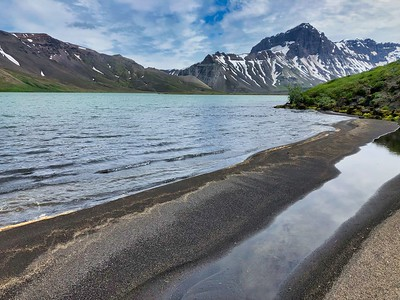
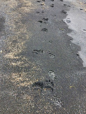
The weather held and we ended up getting all 6 parks done in that one day. What an amazing experience and I cannot say enough good things about Jared (our pilot) and Golden Eagle Outfitters. We flew all over and saw so many amazing views – even landing on little strips of land next to a river. In Gates of the Arctic, we were flying in between the mountain tops, so close you felt you could reach out and touch them. We saw muskox herds in Krusenstern and grizzly bear tracks that appeared to be chasing caribou on the beach in Bering Land Bridge. As we left the beach, we flew over a dead humpback whale carcass, and a little ways away we saw a group of ten grizzly bears all together – which is very unusual. They were likely heading to or had just eaten from the humpback carcass. One tidbit from our pilot is that many people do not want to fly for all 8 hours in one day. So if they have good weather, they do 2-3 hours of flying and then save the rest for the next day. However, because of Alaska’s finicky weather, bad weather may come in overnight and the flight gets cancelled the next day. Our suggestion is that if you have beautiful weather, take advantage of it to the greatest extent you can. Unless you have to for personal reasons, try to maximize your flying time on days you have fantastic weather.

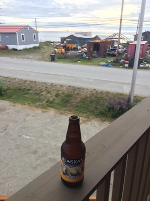
One funny side-note that happened to us in Kotzebue. On our way back from dinner that night, Scott and our friend Brian, who traveled with us throughout Alaska both years, stopped at the town’s liquor store, which was located on the backside of the town’s jail. Inside, you have to pass a background check and buy a permit before you could buy a six-pack of beer, which of course Scott did, even if just for the story. We then went back to the Airbnb, sat on the little balcony area that allowed us to gaze out at the Arctic Ocean and sip a beer. It was a relaxing end to our amazing day of sightseeing.
(Another Pro-tip for Alaska, the farther north you go in the summer, the more daylight you have. We were so far north in Kotzebue, the sun never really set that night and our Airbnb did not have shades or curtains. We actually ran into several Airbnbs that didn’t have blackout curtains. So come prepared with a towel or something to help block out the light).
The next day Scott and I decided to fly back to Anchorage and rent a car to drive to Homer. The first part of the drive was pretty (as you headed west), but once you made the turn to head south, the view wasn’t as good until you drove into Homer. We explored around Homer, going out to the Homer Spit, which had some open camping options on the beach. We stopped at the Salty Dawg Saloon, with its dollar bills stapled on the walls and ceiling and eclectic decor all over. You can camp on the beach on the Homer spit. However, Scott had friends in Homer who had a beautiful view of the mountains from their yard. So we passed on the beach camping and opted to camp in their yard instead. It was so beautiful waking up to that view.
We also visited the Islands and Oceans Visitor Center, which is also the visitor center for the Aleutian Islands WWII National Monument. The next part of our adventure is documented in Part Two of this Five-Part series.

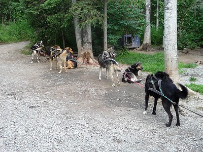
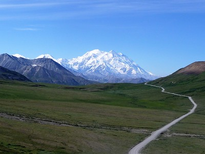
Following our trip down to Homer, our next adventure was to head north of Anchorage to explore Denali National Park and Preserve. On our drive up there from Anchorage, we stopped at the Iditarod National Historic Trail Visitor Center in Wasilla. There is an interesting little visitor center, a gift shop, and a chance to see some of the dogs used in the Iditarod.
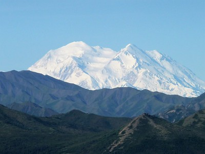
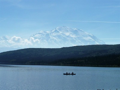
Afterward, we continued on to Talkeetna for a charter flight we scheduled with Talkeetna Air to land on Dall Glacier within the southern portion of Denali National Preserve. It was supposed to be $725 per person for the flight. Unfortunately, when we got there, they informed us that the weather was too bad to land on the glacier. The information they had given us beforehand was that this time of year (late July) they do not land on Dall Glacier that often and they do not have as good of information on the quality of the landing sight. They go there most often in late May and early June, when they are doing landings for the climbers (this is how I did this trip in 2010 with my dad). More information on how Scott eventually visited the northern portion of the Denali National Preserve below. Talkeetna Air also does various flightseeing tours of Denali, including the option to land on a glacier within the National Park boundaries. Seeing Denali mountain from the air is really a breathtaking sight.
After leaving Talkeetna, the drive up to Denali National Park is easy and pretty. You can stop at Mt. McKinley Princess Wilderness Lodge for a drink, a meal, and good views. At Mile Marker 135.2, there is a viewpoint of Denali located in Denali State Park. At Mile Marker 137.2 is the Lower Troublesome Creek Trailhead, which offers a ½ mile walk one-way to the Chulitna River. At Mile Marker 147.1 is the entrance to Denali State Park and visitor center. On the east side of Hwy 3/George Parks Hwy at milepost 188.5, in Cantwell, is Igloo City – Giant Igloo-Shaped Building.
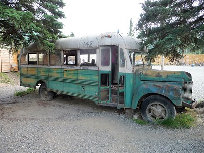
We decided to camp in Denali National Park at the Riley Creek Campground, which was beautiful. Nearby, in Healy, is the 49th State Brewing Company, which has the Into The Wild Death Bus. This is the bus where Chris McCandless lived (and died), which was transported from the wilderness to the brewery. Inside the bus are photos and a storyline of McCandless’s doomed attempt to reconnect with nature.
We opted to explore Denali National Park by taking the Shuttle system through Denali National Park all the way to Kantishna. While it is a long tour (13 hours), it ensures an easy way to see as much of the park as you can. In retrospect, we would have just done the tour to Wonder Lake and back, as there is not much beyond Wonder Lake that warranted the extra time. I’ve done this tour twice, and both times we saw lots of wildlife and I was lucky enough to have a completely clear day (very rare) to see Denali mountain itself.
After we explored Denali National Park, we headed to Fairbanks to catch a flight to Yukon-Charley Rivers National Preserve. At the beginning, we had intended on floating the Yukon River from Eagle to Circle. However, there is very little information online on how exactly to do this. The best I could find is that you rent a raft in Fairbanks, and fly you and the raft and your supplies (paying for all the weight) to Eagle from Fairbanks, and back to Fairbanks from Circle. This was going to be pretty costly and I could never really find any good information online on how to pull this off.
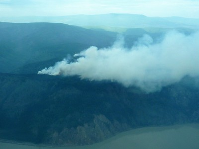
We ultimately decided we didn’t have the money or the time to do a float down the river. So we opted to do a charter flight with Wright Air Service to Coal Creek Camp Airstrip. In 2018, we paid $1,000 for the plane rental, which included exactly 1 hour on the ground. You are charged additional money for the time over 60 minutes that you are on the ground. It was about a 70 minute flight to Coal Creek Camp. The problem we had was that there were three wildfires that had sprung up around that area. So when we took off from Fairbanks, we had no idea if we could actually land there or not. It wasn’t until the pilot got close to the runway area that he decided we could land.
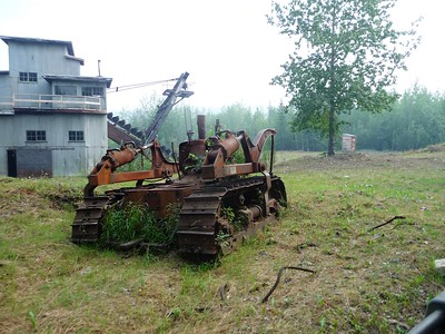
There isn’t much around the landing strip. If you head down the rutted roadway to the west, you will head to the old camp location. It’s not a far walk, maybe a half-mile. If you do this, remember you cannot bring bear spray on the plane and that the area is thick with mosquitoes. If you head east from the runway down the rutted roadway, you will come across some of the old mining equipment of Cold Creek Dredge and eventually get to Slaven’s Roadhouse on the banks of the Yukon river. This walk is about 4 miles one-way. We were originally not going to do this walk because we were being charged so much money for the time on the ground.
We got lucky and ran into some BLM firefighters stationed at the old Camp location. The lead firefighter took us in her ATV (driving very fast) down to Slaven’s Roadhouse and back to the airstrip, and we were only about 5 minutes over our allotted hour. As we lifted off the runway and headed back to Fairbanks, we could visually see the wildfires. So sad to see so much destruction. We ran into some terrible weather on our way back and the pilot had to do some very risky maneuvers to try to get us home. It was a scary adventure, and a good reminder that bush planes are not like regular commercial airliners that have lots of fancy radar to navigate the air. But we did get home in one piece, albeit much later than was expected.
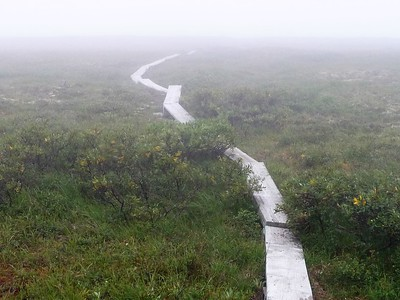
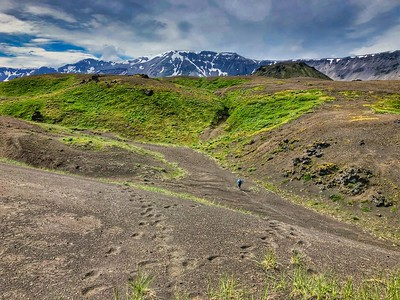
Scott and I also have a quest to go to all the Treasured Places (all the National Park Units, all the National Conservation Areas, and all the National Monuments, no matter who manages them. In early 2020, this was 478 places). One of the Treasured Places is the Steese National Monument managed by BLM. There isn’t much information on this, so here is a Map, the BLM Highway Brochure, and a Steese Highway Travel Guide. The first 81 miles is paved. From the pavements’ end starts a wide, gravel road toward the towns of Central and Circle. As noted above, the gravel road is known to be difficult to drive, especially the close you get to Circle, which is why rental companies don’t allow it. However, we decided to drive the 4 miles from the end of the pavement to mile marker 85, the Twelvemile Summit Wayside. The gravel road here is in great condition and it isn’t difficult to drive at all. At this Wayside, early prospectors named this spot for its location 12 miles from Mastodon Dome, the site of early gold discoveries. A parking area provides access to the Pinnell Mountain National Recreation Trail. This is the location where the boundary of Steese National Monument is closest to the road. There is a small hiking path, often with a two-board “boardwalk” to help you walk on the marshy/boggy areas. The tundra is much different here than other areas, and it was an interesting walk. It was especially interesting for us because it was so foggy and we couldn’t see very far (thus, making it difficult to see bears or for them to see us). There isn’t anything posted telling you that you crossed into the National Monument area, so make sure to bring GPS (we used GPS maps on our phones).
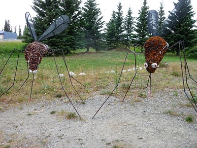
After Fairbanks, we drove down toward Wrangell-St. Elias. We stopped in Delta Junction to see the Highway’s End Mosquitoes: In a little park at the V junction of Hwy 2/Alaska Hwy and Hwy 4/Richardson Hwy, there is a memorial dedicated to the end of the Alaska Highway. Right next to that is a pair of giant mosquitoes. (I thought this was pretty accurate sizing!)
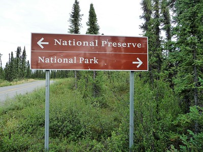
From there, we headed toward Nabesna in Wrangell-St. Elias National Park. The road to Nabesna is full of huge potholes and is a terrible road to drive. It is not impassible, but many rental companies do not allow rental cars to go down this road. From the Slanta Ranger Station if you go to the 5.6 mile marker, you are at a point where the north side of the road is “National Preserve” whereas the south side is “National Park.” If you want to go further or explore more, here is the Road Guide.
We ended up camping at the Squirrel Creek State Recreation Area, which is first come, first serve. You can also camp at the Liberty Falls State Recreation Area, which is also first come, first serve. We found a campsite along the little river and there are some great little areas to explore.
To get to McCarthy, the road is in questionable condition, and can sometimes have old railroad spikes come through the ground. While it is certainly drive-able, there is a higher likelihood of puncturing a tire. Which is why rental companies do not allow you to drive a rental car down the road. We opted to take the Kennicott Shuttle. The Shuttle picked us up right from the campground at 7:45 and we arrived at McCarthy at 11:00. During the summer, there is a private shuttle that transports visitors between McCarthy and Kennicott for a fee of $5 one way. The Kennicott Shuttle left McCarthy at 16:30 and dropped us off at the campground around 19:45. Kennicott is a cute, old mining town that is fun to explore on foot. There are many hiking trails, views of glaciers, and old reconstructed and refurbished mining buildings to explore.
The next day, we decided to head to Valdez and check out this small coastal town. On the way, we stopped at the Worthington Glacier State Recreation Site, to view the Worthington Glacier.
This is a very easy site to visit and see a glacier without much hiking effort. This was the end of our July 2018 trip. We loved Alaska and definitely looked forward to the next summer’s trip. The beginning of our July 2019 trip follows in Part Three of this Five-Part series!
In 2019, we headed back to Alaska, hoping to mark off the rest of the Units and for Scott to finish his quest to visit all of the National Park Units.
We flew to Yakutat on Alaska airlines from Arizona. Once in Yakutat, first up was trying to fly to Dry Bay in Glacier Bay National Preserve. While I think you can do this flight from Juneau, not everyone flies there or guarantees a charter flight. We decided to fly with Yakutat Coastal Airlines from Yakutat. They were not easy to get ahold of, and while they were ready for us when we landed in Yakutat, when our friends landed in Yakutat a week later to do the same flight, they had completely forgotten about them. In 2019, it was $575 to fly to Dry Bay, walk around on the ground for a few minutes, and then fly back. The pilot flew other individuals and cargo in the plane, making another stop along the way, and seemed generally disinterested in having us along. But, we did make it to Dry Bay and put our feet on land there. The pilot certainly was not interested in giving us any time to walk around though.
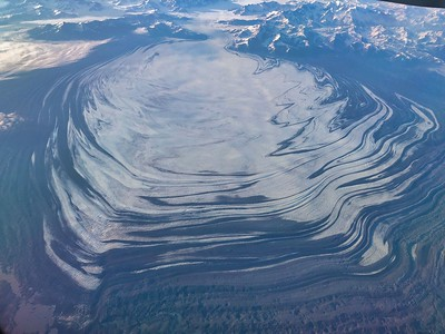
We had asked in advance if the pilot could possibly fly over the Malaspina Glacier – the largest piedmont glacier in the world and is the approximate size of Switzerland – across the bay from Yakatuk, but he very quickly and flatly said no. Later on in the trip, we got lucky and ended up flying over it in a commercial airplane, with a fantastic view. It was definitely worth seeing.
We stayed at the Glacier Bear Lodge, which was nice and ended up being a great place to hang out until we left. It is definitely designed more for fishermen and it wasn’t fancy. But it was definitely adequate and comfortable. The second day we were in Yakutat, it was pouring rain. Since the town is tiny and there isn’t much to see, especially when it is raining, we hung out at the Lodge most of the day. Here are some of the other things to do in Yakutat: Flightseeing tour to Hubbard Glacier, Alaska’s largest glacier (Alsek Air Service, Yakutat Charters, Yakutat Charter Boat Company); beachcombing, especially at Cannon Beach; rent a fat tire bike (Ross Outdoor Adventure); see cannons that protected the area during WWII, an old military tank, WWII era hangar (home of a future WWII aviation museum); and see the “Fish Train”.
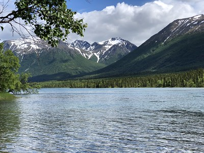
The next adventure was to fly to Lake Clark National Park and Preserve. We flew to Anchorage from Yakutat on Alaska Air, and then drove to Lake and Pen Air, which is located at the Merrill Field Airport. We had decided to do just a day trip to Port Alsworth ($498 per person r/t). The flight to/from Port Alsworth was amazingly beautiful. We flew down the coastline, seeing whales in the ocean. Then we turned inland and flew down a valley, with beautiful mountains and glaciers surrounding us the entire time. This was the most gorgeous part of the trip to Lake Clark.
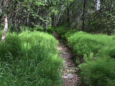
Once we landed, we walked to the other end of the runway and headed out on the hiking path toward Tanalian Falls (which can be a loop if you want). The trailhead was easy to find and well signed. Including the hiking down/back on the runway, it was about 9 miles round-trip to walk from the Lake and Pen Air office to Kontrashibuna Lake. We decided to head out on the loop trail going clockwise. The first part of the hike (Beaver Pond Loop) was a little less steep but the path was very narrow and very dense vegetation ringed both sides of the path. It was a bit hard to walk and it seemed like prime bear habitat (although we did not see one).
Along the way, we stopped at a little lake along the way to rest.

Finally we got to Tanalian Falls, which were so pretty and peaceful. I could have hung out here for awhile.
We continued walking toward Kontrashibuna Lake, to ensure that we crossed from the Preserve boundary into the Park boundary to mark off both. The lake was also very peaceful.
We hiked back to the Tanalian Falls and then took the Falls and Lake Trail back. This trail was much wider and was generally downhill (although sometimes steep and rocky at times).
Once we left Lake Clark, the views of the mountains and the waters below were amazing.
If you spend any time in Anchorage, which you likely will, here are some other things to do in and around Anchorage. Just outside Anchorage to the south, there is the Potter Marsh Boardwalk, which is a ½ mile walk around a marshy area, and a nice place to stretch your legs.
If you chose to go to Whittier, just before the tunnel (more below) is the Begich, Boggs Visitor Center ($5 pp), that will give you more information on the area, including Portage Glacier. You’re able to see the Portage Glacier by either taking an hour-long sightseeing boat cruise on Portage Lake with Portage Glacier Tours (several times per day; $39 pp but there is an online coupon for $5 off pp); or hike on one of a number of foot trails that lead to the glacier. One such trail is the Portage Pass Trail – a 5.4 mile r/t moderately trafficked out-and-back trail that features a lake and is rated as moderate. The first .75 to 1 mile is a steady climb up, but after that is fairly flat, although you may have to cross a river/stream. To access the trailhead you must pay a toll and drive through the Whittier tunnel. Once on the Whittier side, take the first right past the railroad tracks onto a gravel road marked “Forest Access.” The trailhead is on the right. Trail Map.
The Whittier Tunnel is a controlled one-lane tunnel with alternating train and vehicle traffic. Vehicles wait in a staging area at each end until a scheduled departure at fifteen minute intervals. The toll is $13 for a vehicle, r/t.
From Whittier, you can do a cruise of Prince William Sound – we chose Phillips Cruises & Tours: the Glacier Quest Cruise (5 hours, $129 pp, departs 1:00 pm, returns 4:45 pm; 11:30 tunnel entrance; $387pp + taxes; includes hot meal). As I mentioned earlier, this is a great tour if you want to see many calving glaciers. It also does not go out onto open water, so the water is quite smooth, reducing any chance of seasickness.
Also to the south of Anchorage, on your way to Whittier or Seward, is the Ski Resort in Girdwood [Alyeska Resort]. During the summer, they have an Aerial Tram ($35 pp or $45 pp Dine and Ride w/ $20 credit at the Bore Tide Deli & Bar).
If you want to see the other side of the Turnagain Arm, drive to Hope, Alaska. Hope is an old gold-mining town.
If you want to explore to the North of Anchorage, there is plenty to do. You can drive the approximate 1.25 hours to Hatcher Pass – one of the highest scenic drives in Alaska that gives you amazing views over rolling mountaintops and alpine tundra. The Palmer-Fishhook Road is paved until mile 17.5, but the next 15 miles is a rough, narrow, and steep gravel road and is not recommended for RVs, trailers and large vehicles. The drive can be slow, but the views are worth it. The road ends at mile 71.2 on the Parks Highway near Willow.
Along this route is the Independence Mine State Historical Park ($5 parking fee) – a gold mine that was active until the 1950s and has a self-guided tour. You can also go to the Summit Lake State Recreation Area – located at Mile Marker 19.2. Summit Lake is a small cirque lake, or tarn, reaching a depth of 20 feet. This cirque was the beginning of a long-gone, alpine glacier. The surrounding terrain is all glacially carved. North of the lake, the uneven ground is caused, not by boulders, but by frost action in combination ground moisture and soil type
If you decide to go to Palmer, you can stop at the Musk Ox Farm ($11 pp; 10:00-18:00; 12850 E. Archie Rd. Palmer, Alaska 99645); the Eklutna Village Historical Park ($5 pp – guided tour to the old log Russian Orthodox Church, see the Spirit Houses, and visit the new Orthodox Church); or walk the Rodak Nature Trail at the Eagle River Nature Center (¾ mile loop; $5 parking fee).
You can even walk along the Thunderbird Falls Trail. Take the Glenn Highway to the Thunderbird Falls exit near Mile 25, the first exit north of Mirror Lake. The trailhead is less than a mile north on the Old Glenn Highway. You can also exit at Eklutna: turn toward mountains and then drive south on the Old Glenn past the turnoff to Eklutna Lake. $5 fee or state parks parking pass is required. The trail itself is one mile one-way, out and back. The trail climbs steeply at first, gaining about 100 feet in elevation. Then the route levels out and becomes an easy walk.
If you are in Anchorage, you can see the Ship Creek Viewing Platform (where you can see the salmon swim upriver); and Resolution Park and Captain Cook Monument (for beautiful views of the mountains). You can also go to the Anchorage Public Lands (NPS) Office (605 West 4th Avenue, Suite 105; Anchorage, (907) 644-3680; open daily 9:00 AM – 5:00 PM).
After spending the evening and the next day hanging out in Anchorage, next up was flying to Fairbanks and trying again for Denali National Preserve. This time, we were opting to land on a lake in the Northern portion of the Preserve. In 2018, we had called Shadow Aviation, in Fairbanks, to see if the owner could fly us to a lake in the northern portion of the preserve. The owner said he does fly there, but he was busy at the time we called. When we called him in early 2019 to set up the same flight for the upcoming June, he said that he did not get the requisite permits for 2019. So, we ended up going with Alaska Fly In Fishing ($1,320 charter for two, 30 minutes on the ground). I had already done the Preserve in 2010, so this was just for Scott and Brian. They had a great flight and the pilot and the company were excellent. The pilot even gave them piggy-back rides so they could put their feet on dry land and not have to wade through the water. While we generally didn’t have to deal with mosquitoes on either of our two trips, this was one place the guys wished they had bug repellent.
We opted to hang out at some breweries and play trivia the rest of our short time in Fairbanks, but here are some other things to do in and around Fairbanks: Aurora Ice Museum at Chena Hot Springs; Chena Hot Springs; Santa Claus House in North Pole; Pioneer Museum; Fountainhead Antique Auto Museum; Georgeson Botanical Garden; Fairbanks Ice Museum and Aurora Show; Alaska Native Heritage Center; Museum of the North; Pioneer Air Museum; Goldstream Dredge No. 8; Fountainhead Antique Auto Museum; and Manley Hot Springs Roadhouse (oldest standing Roadhouse in Alaska).
For our adventures in the Alaskan Peninsula, please go to Part Four of this Five-Part Series!
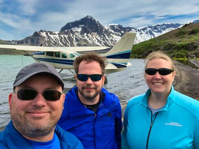
Our Alaskan adventure continued in King Salmon, in the Alaskan peninsula – and oh boy did we have some adventures! King Salmon is a tiny village consisting of 2 bars/restaurants, a market, a bank, a hotel, the King Salmon Interagency Visitor Center, an airport with a gift shop, and a car rental place. We stayed at the Antlers Inn, which offers very basic rooms. You can walk just about everywhere in King Salmon, so a rental car is not needed if you are staying in town. (More on this later).
We knew that it could take a long time for the weather conditions to be favorable enough to get to Aniakchak National Monument and Preserve, so we booked 6 full days in King Salmon. The key to visiting all 5 National Park units here is flexibility. Our recommendation is to figure out what is the most important thing for you to do, then schedule the number of days you are willing to spend in King Salmon to make that thing happen. Once you figure this out, arrange your bush flights with one company, focusing on what destination is most important instead of specifically scheduling certain destinations for certain days. For us, the most important thing was making it to Anaikchak. So our plan was to focus on getting Aniakchak done and then working in the other parks as time and weather allowed. We decided to go with Branch River Air since they were easy to work with and a friend of ours had a great experience with them in 2018. In 2019, they charged $550 per hour of flight time and I think our final bill for all 5 parks was about $3,500. Other options include Katmai Air and Trygg Air. The folks at Branch River Air were beyond amazing and accommodating and we highly recommend them.
In the days leading up to us flying into King Salmon, the weather had been great in the area. However, the day we flew into King Salmon, the crappy weather rolled in down near Aniakchak, even though it was still sunny in King Salmon. So we scratched Aniakchak for the day and flew to Katmai National Preserve, landing on Nonvianuk Lake.
We also were able to land on Alagnak Wild River. It was still a bit early in the year for this, but the pilot was telling us how in July, they land on the River and the salmon are so thick in the river and around the plane that one can barely get around.
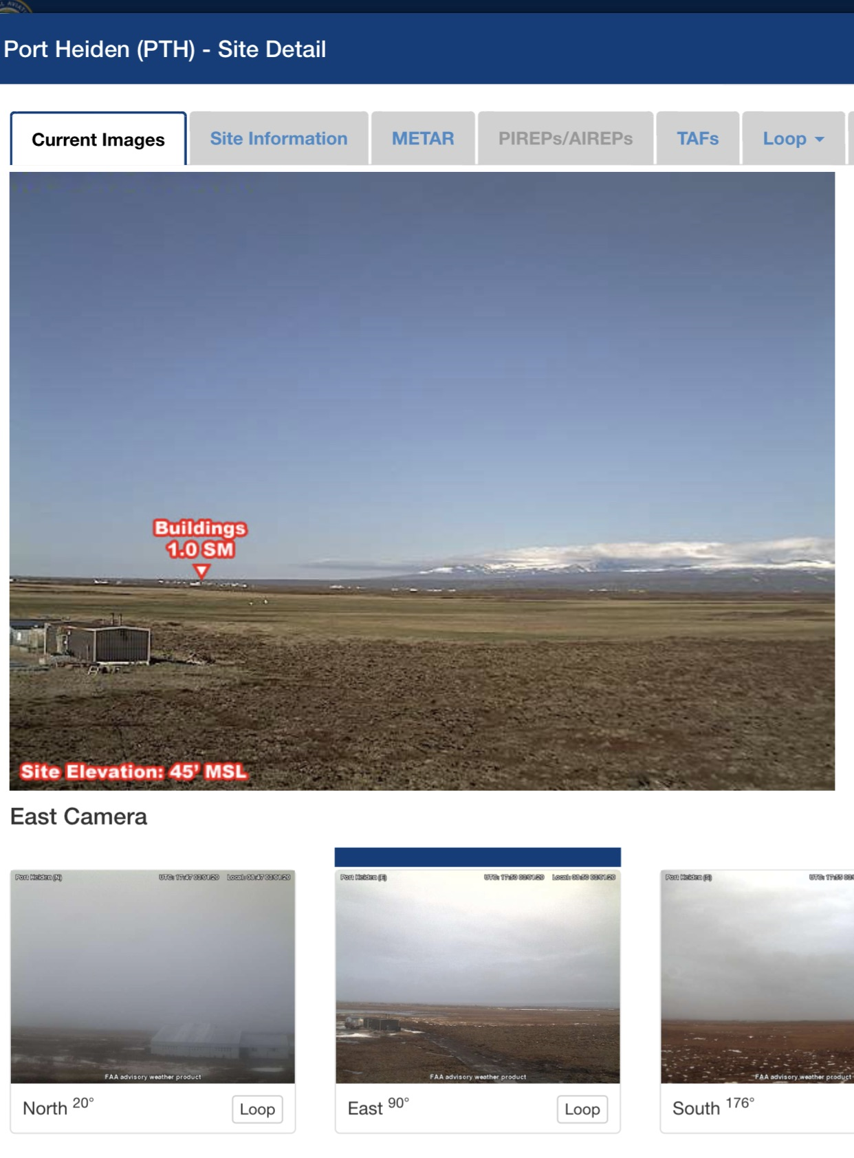
The next day, the weather was even worse, so we spent the day walking around town. A little tidbit, the FAA has webcams installed around Alaska, which will give you a real-time look at weather in the area. I believe they are updated about every 10 minutes. For the best view of Aniakchak, look at the Port Heiden camera – the East View. As you can see in this screenshot, the large picture is what the Aniakchak crater looks like on a clear day. The camera shot below for “East” is what we looked at for almost 5 long, boring, and stressful days, becoming more and more skeptical of whether we would ever be able to go. We heard a story of how someone had been in King Salmon the year prior for 10 days and was never able to make it to Aniakchak. Even the NPS superintendent for Aniakchak had never actually been able to make it down there. We were checking the webcam every 10 minutes and calling in with Branch River Air almost every 2-3 hours, as sometimes the weather can suddenly clear.
On the third day of waiting, we were very bored and so we decided to spend $255 on a 24-hour rental car to drive the 15 miles to the only other village in this area – Naknek – simply so we could eat at a different place. Before going there, we decided to first drive east out of King Salmon toward Lake Camp, the Katmai National Park Boundary. While Brooks Camp was our ultimate destination for Katmai National Park, since things weren’t going well for us, we wanted to make sure that we at least put our feet within the Park Boundary, even if we didn’t make it to Brooks Camp that year. The roads are either paved or really great gravel – so it’s easy driving. Once we did that, we then drove to Naknek.
Naknek is basically a fishing town and a large salmon cannery. People come here from all over the world to work long hours at the cannery. Naknek is not much bigger than King Salmon, but it was something different. We ate at the D&D Restaurant, went and had a beer at the Fisherman’s Bar, and we drove down toward the beach to check that out. It was nice to get out of King Salmon, even at the expense of a $255-per-day rental car.
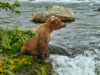
On the fourth day of waiting for Aniakchak to clear, we decided early- to mid-afternoon that Aniakchak likely wasn’t going to cooperate for us again. So we looked at flying to Brooks Camp. This was still the end of June and it was definitely possible the bears had not shown up at Brooks Falls yet. We had such awful WiFi that we were not able to check the Webcam to see if it had gone live and whether there were bears at the falls. So, we posted the link to the webcam on social media and asked our friends to check for us and let us know. After several messages to us later – We were in luck! There were a few bears. So we called our friends at Branch River Air and we were on our way.
When we landed on the water and pulled up to the beach at Brooks Camp, the rangers met us and escorted us almost immediately to the NPS building for “bear safety class.” Here, they talk to you about grizzly bears, what to do and not to do, and overall bear safety. Once you finish the class, you’re free to go wherever you want. We only had a few hours there, so we headed immediately to the wildlife viewing platforms at Brooks Falls (map). First, you head down a well-groomed path and cross the newly-constructed bridge over Brooks River toward the lower river platform. Then follow the signs along a gravel road to the Brooks Falls Trail, which is a well-groomed path to the two viewing platforms. Until you get close to the viewing platforms, this is a regular, “open-air” walking path. Make sure you are making noise and watching out for bears. It’s maybe about a mile from the lower river viewing platform to the falls platform.
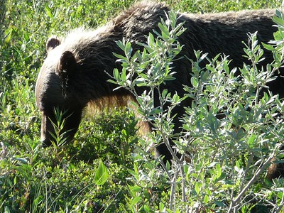
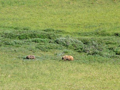
We got lucky because when we got to the falls platform, not only was there a bear there, but there were only about 10 other people. So we could stay as long as we wanted. If it is too crowded, they only let you stay for an hour. The bear we saw was likely an older juvenile who was trying to get the hang of fishing on his own – he wasn’t very good at it, which provided much entertainment. Finally, after quite some time, he did manage to snag a fish, only to have a seagull steal it right out of his mouth! (This is why we nicknamed him DAS – dumb as s#&%).

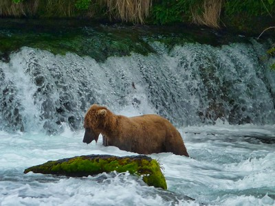
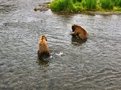
Eventually, another bear came who was adept at fishing. DAS got smart and tried to steal the fish from this new bear. This led to a fight between the two bears, almost directly below us on the viewing platform. The growling and fighting between the two could be heard all the way down at the lower river viewing platform, a half-mile away as the crow flies. It was a glorious experience.
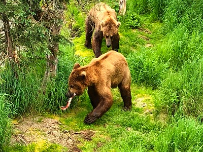
After watching the bears for a couple of hours, we knew we had to hike back to meet our plane. As we were walking back on the Brook Falls Trail, talking loudly and trying to make noise, all of a sudden, out of the corner of my eye, I saw two grizzly bears running directly at me. Complete instinct took over and I yelled and jumped forward (what seemed like 25 feet). The bears, likely older juveniles (but were still huge) were definitely fighting one another, growling and snarling. Like we were taught, we quickly got off the trail at a 90 degree angle in the opposite direction. The problem was, the vegetation on either side of the trail was very thick. So Scott was the only one who saw the huge felled tree on the ground. Brian tripped over the tree, and I basically face-planted over it. Once righting ourselves, we hid behind a tree that was about 2 inches in diameter (because of course that will protect us) and watched the fighting bears, trying to figure out what we should do. By this point, the bears were clearly in a tense stand-off across the trail from us and about 10 yards up, with one of the bears having his back to us. Should we stay there and be quiet, waiting for them to leave? Well, that could be awhile and they could come at us again. Should we make noise and alert them to our presence? Well, that could threaten the bear with his back to us, thinking he was being attacked, and they could come after us. Should we sneak back onto the trail and get out of there as quickly and quietly as we could? We all had different ideas and were communicating using sign language. At one point, Brian pulled out this little tiny bear bell, signaling to us that he had it to make some noise. Scott and I quickly out-voted him when we lunged at the bear bell to ensure it didn’t tinkle and make noise. Finally, after many tense moments, we decided to sneak back onto the trail and around the corner to get out of there quickly. We did so without incident and started back toward the Camp. As we walked back, talking excitedly about our crazy bear encounter, we came across a woman who was walking toward the falls platform. After telling her that there were two fighting grizzlies about 100 yards up the path, she decided to walk back to the Camp with us.
Once we got back to the lower river platform, we saw a ranger and told him about our experience. He said this type of thing happens a lot, but the bears know what people are and were not concerned about us. We felt he was likely lying to us to make us feel better. We got to talking with him, telling him of our experience overall in King Salmon. To which he replied – Oh! You guys are the ones who have been waiting for days to get to Aniakchak! Our fame apparently had spread far and wide along the Alaskan peninsula.
We then walked back to the beach to wait for our plane, getting to watch a mama bear and her cubs about 200 yards up the beach.
The one thing that we were not able to make happen this trip was the daily bus tour with Katmailand to the Valley of Ten Thousand Smokes. It is $96 per person round-trip (with a sack lunch included, $88 without), and the 7-hour tour runs daily from at 9:00 am. The tour is both a bus ride and a 3.4-mile moderate hike.
To find out if we actually made it to Aniakchak, and read about the final part of our trip, go to Part Five of this Five-Part Series.
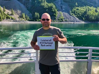
Do we make it to Aniakchak or not?!?! On the fifth day, we were getting pretty worried that Aniakchak wouldn’t happen, especially when we again woke up to grey skies and fog. We were supposed to leave the next day, so in the early afternoon, we started talking about whether we should rearrange the rest of our trip to stay a few extra days or wait until another year. Brian was opting to wait for another year, as there were more things he wanted to do in Alaska and would be returning. Scott was so close to finishing all 419 national park units (2 left after Aniakchak), that we decided to see if we could rearrange the rest of our trip to add a few more days trying for Aniakchak. The Antler’s Inn had already rented out our room, but had another room we could look at. We checked it out and decided to stay another 2 days. The problem is, I actually had a surprise waiting for Scott as he finished his National Park quest – our friends Matt and Rebecca had flown up to Alaska and were waiting to surprise Scott in Juneau. (I also had special shirts made for everyone to wear at the last unit.) Luckily, I knew Matt and Rebecca would be understanding if we didn’t join up with them to try to finish this unit. As we were walking back into our room, I knew I had to spoil the surprise and tell Scott what was awaiting him in Juneau, so he could make a fully-informed decision on staying.
But as we were literally walking into our room to have this discussion, Scott gets a text message from Van at Branch River Air – meet us at the office in 45 minutes for a chance at Aniakchak!!! We checked the webcam and holy cow – the clouds were clearing around Port Heiden! We scrambled around getting our stuff together, and I ran to the owner of Antler’s Inn to tell her we were trying for Aniakchak (after five days of trying, they were really invested in our attempt to get there). The owner yelled to her daughter to quit cleaning the van, which is what she had been doing, because the owner was going to take us to Branch River Air herself! We all jumped in the van and flew down the road the mile to the Branch River Air office. We knew that at any time, the clouds could come back in and our trip had to be aborted. We could even get 99% of the way there and have to turn around, unsuccessful. So we took off from King Salmon with high hopes, but knowing we could have to pay a lot of money to not mark off the unit.
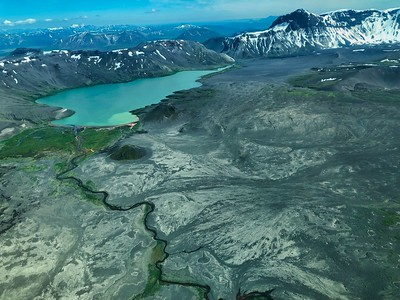
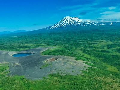
As we flew further and further south down the peninsula, the weather got better and better. The clouds were lifting, blue skies were shining, and by then time we got down there, there wasn’t a cloud in sight. It was amazing. After the volcano last erupted, it filled with water, creating a lake. After some time, the water broke through the side of the caldera, now known as The Gates, and the volume of water inside the caldera, roughly the volume of the Mississippi River, rushed out of the caldera and flowed to the ocean. The Gates is the small and narrow entrance-way to fly into the caldera, and a small lake remains inside – Surprise Lake. It’s difficult for pilots to navigate through the Gates, as often the top of the caldera is full of clouds/fog and it’s hard to see. As we approached the Aniakchak caldera, however, there were no clouds at all. The pilot took advantage of it and flew us directly over the top of the caldera so we got a birds-eye view of the Monument! Wow – totally amazing.
After flying over the top, the pilot circled around to land on Aniakchak National Preserve. The lake in the Preserve is very shallow, so the pilots are only able to do a touch-and-go landing. But that was okay. While we were flying around to do the touch-and-go landing, we unexpectedly flew over a ridge where we saw two grizzly bears procreating. The male bear even stopped what he was doing and the two bears looked up at us, and then went back at it again — oops!

After the touch-and-go landing, we circled around and flew through The Gates. As we came in for a landing on Surprise Lake, I had tears streaming down my cheeks – We Had Made It!! Scott was going to finish his National Park Quest!
We got out of the plane and hiked around for awhile, taking in all the scenery. Our pilot was awesome and said basically we could stay as long as we wanted (no charge). It was so amazing.
On our way back, the pilot asked if we wanted to take advantage of the clear skies and fly up the mountain range, instead of across the flat land we flew across coming down. It would cost us a bit more, but it was a unanimous “yes” from his three, grateful passengers. It was a beautiful flight back and we were so fortunate to have had this experience.
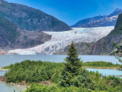
The next evening, after six days in King Salmon, we finally flew on to Juneau to finish Scott’s quest. The next morning, I went and picked up our friends, under the guise that I had shipped something to a store in Juneau in the event Scott would finish his quest. Scott was completely and utterly surprised when he saw them (which is hard to do with him). I drove all four of them to the airport where they took an Alaska Airlines flight to Sitka. I had already done the Sitka National Historical Park in 2010, so I stayed back in Juneau. I spent most of my day exploring around Mendenhall Glacier, which was some great walking and exploring. It can definitely get busy with the cruise ship passengers though. After Scott, Brian, Matt, and Rebecca got back that evening, we went back so they could see the glacier and we were virtually the only ones there.
At the end of June 2019, Alaska ended up having a significant heat wave. I had no idea that heat could actually create a lot of turbulence to fly, as well as waves, but it apparently does. The next morning, we were supposed to fly with Ward Air to Pack Creek at Admiralty Island National Monument. (That flight was $684 for the aircraft to fly 4 of us). You do need to get a permit to visit Pack Creek between June 1 and September 10. (Between July 5 and August 25, visitation is limited to 24 visitors per day. Half of the 24 permits available are for public purchase, the other half are reserved for commercial companies to provide guided tours to Pack Creek. Permits are not required between September 11 – May 31.) However, the day we were to fly there, the sun was so bright and it was so hot, it created waves too big to land a floatplane on. So, instead, the pilot flew us to Hasselborg Lake, where we got to see the Big Sheehan Cabin (a basic bunk-house). The scenery was pretty there and back, although it was a pretty turbulent plane ride.
Finally, the next day, we flew on an Alaska Air flight to Gustavus. The terminal is tiny, and we all waited outside for the airline folks to put our bags in this little box-like thing for us to retrieve one at a time. The Glacier Bay Lodge, where we were staying, had a bus waiting for everyone to transport folks through the tiny town of Gustavus to the Lodge. The Lodge was nice, although nothing fancy. We did walk around and see the various interpretive signs along the walking paths.
The next day, we boarded the Boat day trip to venture into Glacier Bay National Park – Scott’s very last National Park Unit. We had a great ranger, who (unlike many others we have chatted with along the way) truly understood what a significant quest this is, and she made the entire day so enjoyable and celebratory. I had special t-shirts made for our group to celebrate Scott’s last part unit, and people on the boat were so much fun to talk with. The boat ride was about 8 hours and we saw lots of wildlife and glaciers. It was definitely an amazing ending to this decade-plus-long quest of Scott’s.
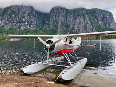
That night we flew back to Juneau, where it was still historically hot. The next morning we parted ways with all our friends, as everyone made their way onward. Scott and I flew to Ketchikan, where we stayed with our friends. While in Ketchikan, we visited the Southeast Alaska Discovery Center and the Totem Heritage Center, and generally explored the area. We also finished our last Treasured Place in Alaska, the Misty Fjords National Monument. We decided to take our 2-hour flight with Island Wings Air Service, which included 30 minutes on the ground ($239 per person). It was such an amazing flight. So much beautiful and different scenery than what we had seen previously, and definitely an amazing way to end our Alaska journey.
Some other things in Alaska to explore that we will have to do on other trips: Aleutian Islands WWII National Historic Area in Unalaska;Fort Abercrombie State Park on Kodiak Island; Kodiak Wildlife Refuge Visitor Center; Baranov Museum (In the oldest standing building in Alaska); Bering Land Bridge Visitor Center – Nome; Scenic Drives and hot springs around Nome.
One sub-unit that we did not make it to was the Klondike Gold Rush NHP in Skagway (we visited the sub-unit in Seattle). To get there, Fly Alaska Seaplanes flies several flights per day between Juneau and Skagway (45 minute flight; $298pp r/t). The Visitor Center is located on the corner of 2nd and Broadway in the Skagway Historic District in the former White Pass & Yukon Route depot. There are three distinct units: Skagway Historic District that has 21 restored historic buildings in town; Dyea Townsite and Chilkoot Trail – the trail is located about 9 miles from Skagway and the Dyea Townsite is 10 miles; and the White Pass Unit – the least accessible to visitors as there are no roads or trails to the White Pass unit. You can also do some Hiking around Skagway. Another recommendation is to do the White Pass & Yukon Route Railroad Train Excursion – Bennett Scenic Journey (you need a passport) – travel 67.5 miles by train between Skagway, AK, and Carcross, YT, along the same route that the Klondike stampeders traversed in 1898. Bennett, BC is only accessible via the White Pass train or by hiking the world famous Chilkoot Trail. Then there is a bus return to Skagway (8-hour tour; $239 pp). If you aren’t interested in going into Canada, you can always do the White Pass Scenic Excursion – Relax in vintage passenger coaches as you retrace the original route to the White Pass Summit, passing Bridal Veil Falls, Inspiration Point and Dead Horse Gulch. Enjoy a breathtaking panorama of mountains, glaciers, gorges, waterfalls, tunnels, trestles and historic sites. See the original Klondike Trail of ‘98 worn into the rocks, a permanent tribute to the thousands of souls who passed this way in search of fortune (2 ½ hour tour; $130 pp).
Alaska is such an amazing state with so much to see and do. After multiple trips there, we decided the best way to really experience Alaska is by the air. It gives you a much better view and appreciation for how vast a place it really is. Most people see Alaska via a cruise, which definitely has its advantages and you see amazing coastline. But to really see Alaska, you also have to get into its wild and vast interior. Ideally, one would combine all three – cruise up the coast, rent a car in Anchorage and drive through the interior, and take several overflights. We guarantee it is an experience you will never forget!